Spatial and Temporal Analysis of Landholdings and Farm Fragmentation in Peshawar City District, Pakistan
Spatial and Temporal Analysis of Landholdings and Farm Fragmentation in Peshawar City District, Pakistan
Samiullah*, Mohammad Aslam Khan and Atta-ur-Rahman
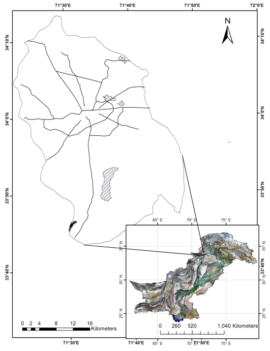
Location of capital city district Peshawar.
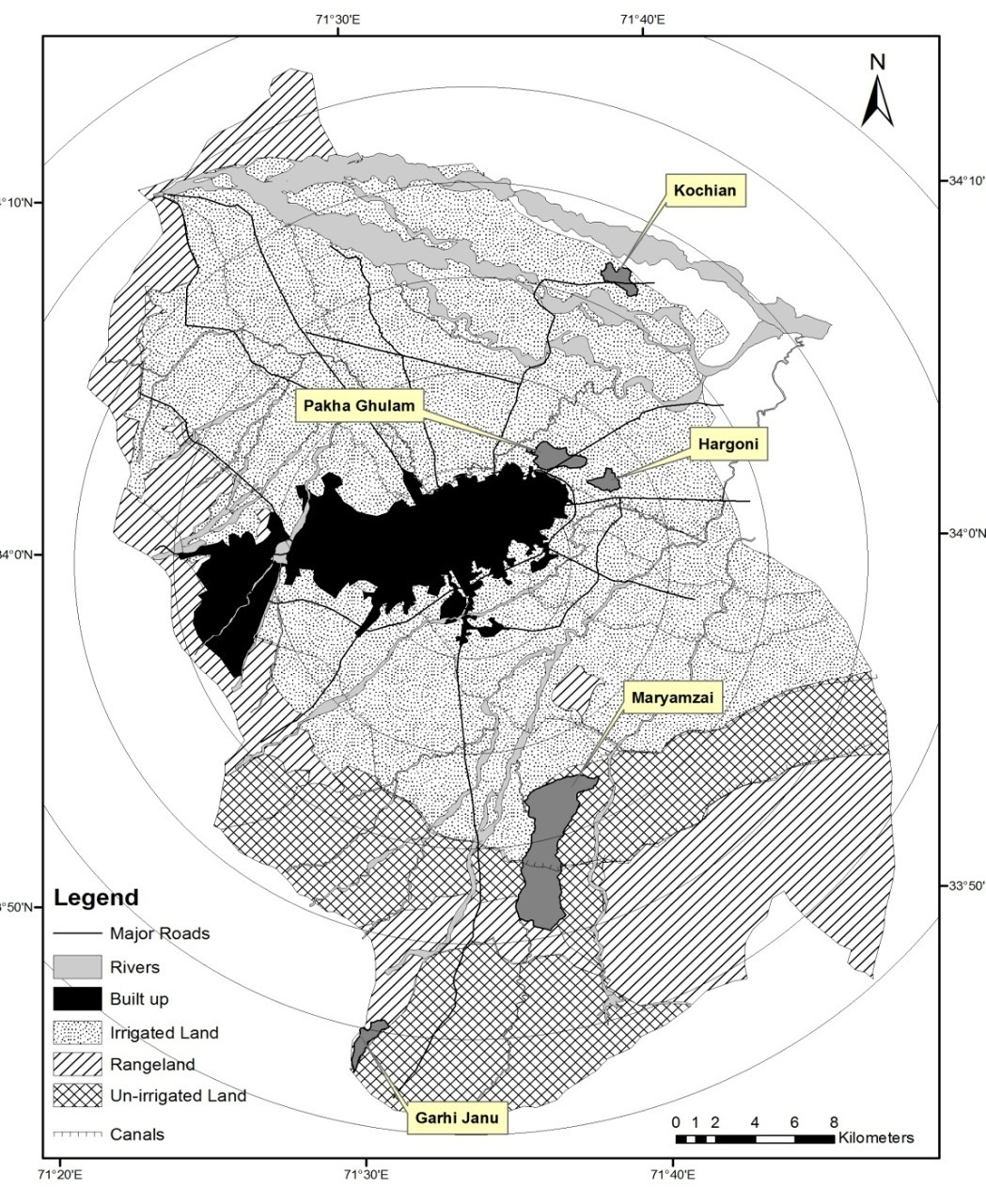
Location of sample villages in capital city district Peshawar.
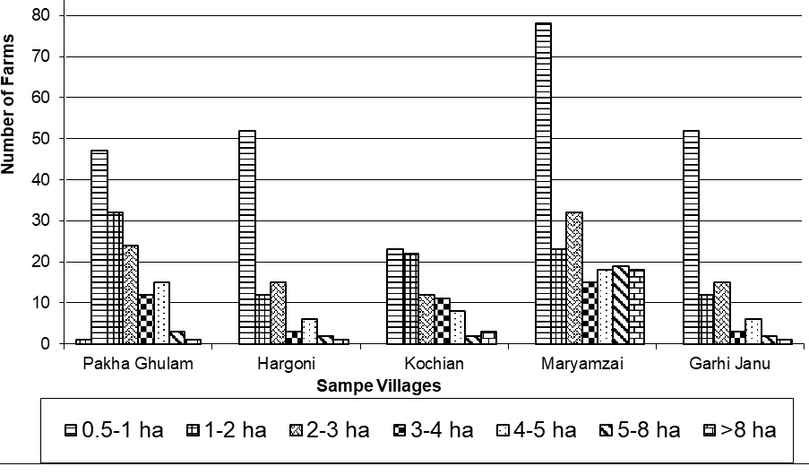
CCDP, Farm Ownership by size in Sample Villages.
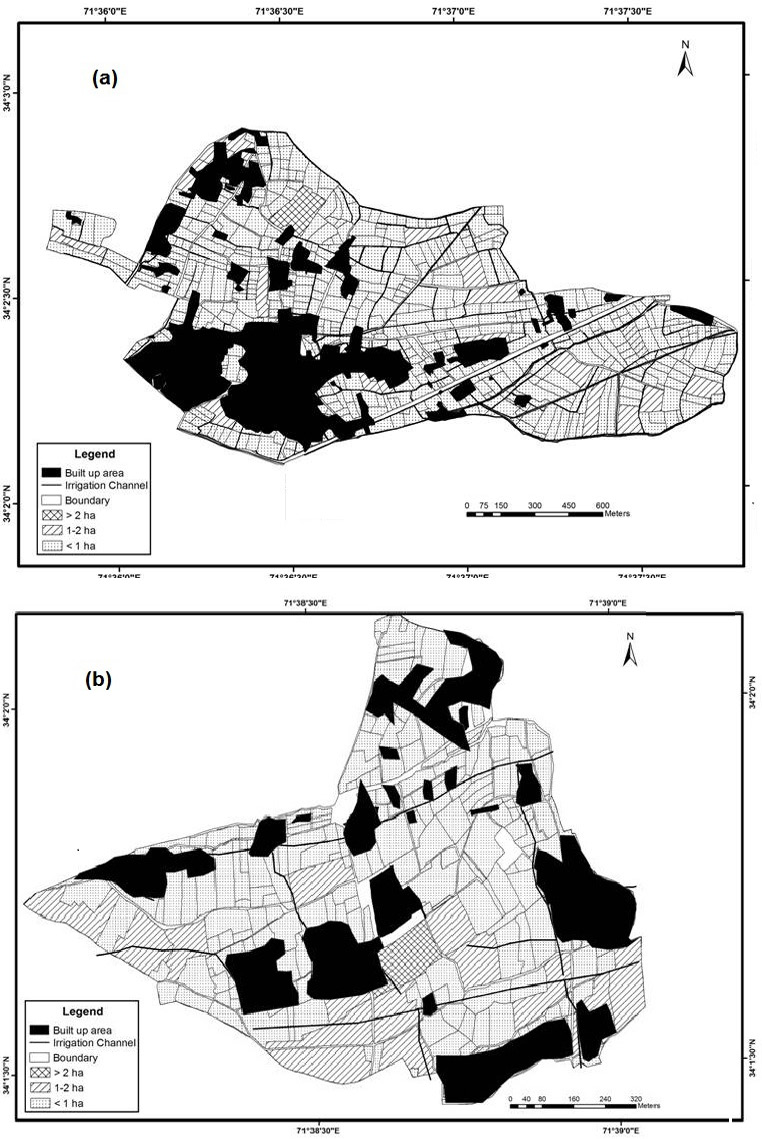
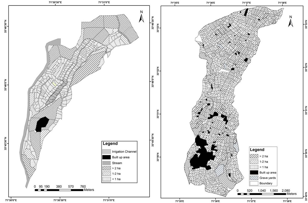
Farm Size in Villages (a) Pakha Ghulam and (b) Hargoni, 2011.
Farm Size in Garhi Janu and Maryamzai, 2012.
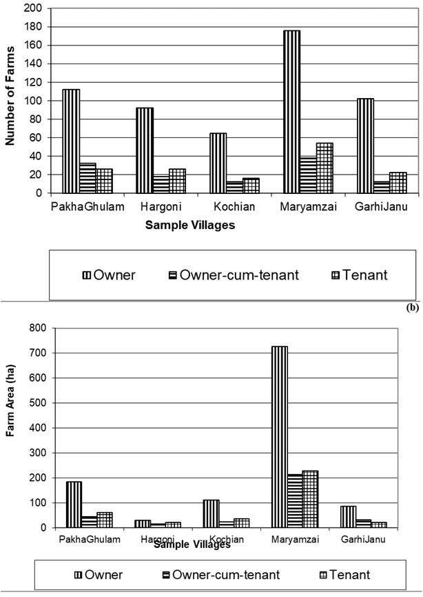
Tenure by (a) Number of farms (b) Area, 2012;
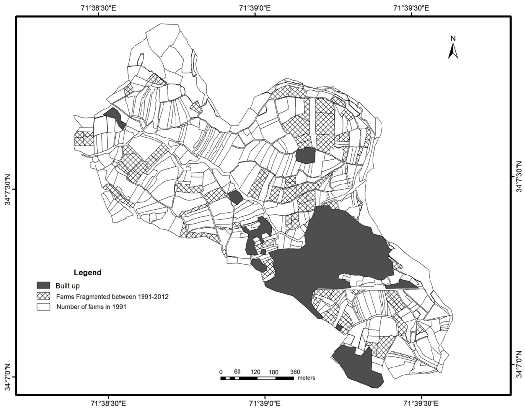
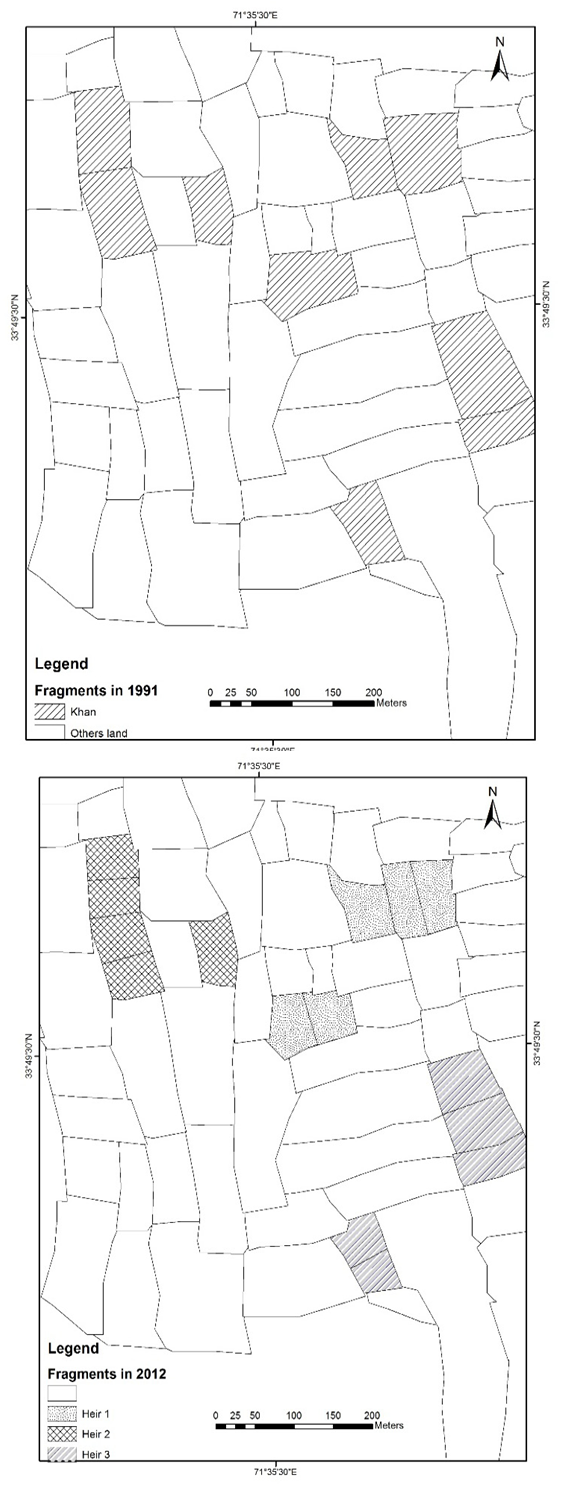
Farm fragmentation in Kochian between 1991 and 2012.
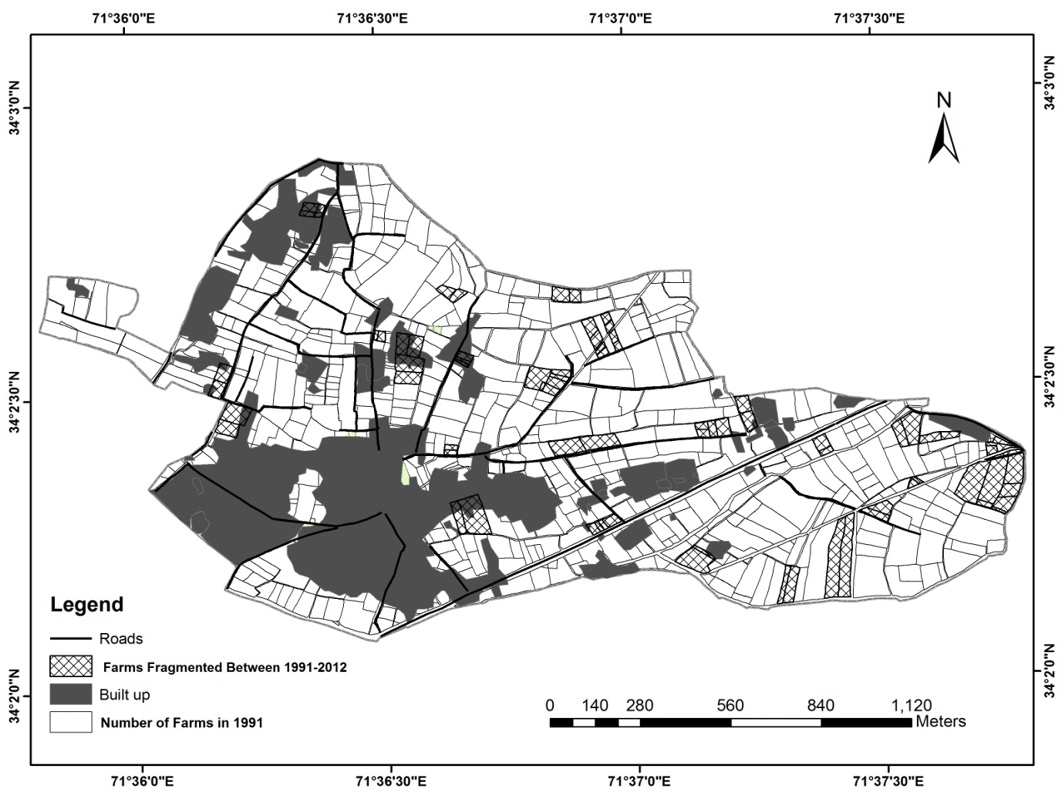
Farm fragmentation in Pakha Ghulam between 1991 and 2012.
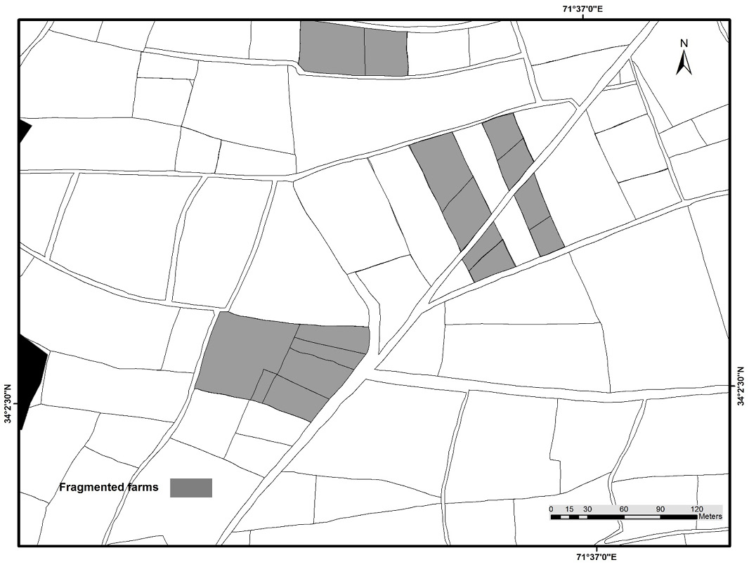
Fragmentation of a sample farm in Pakha Ghulam (rain fed and irrigated).
Fragmentation of a sample farm in Maryamzai (rain fed area).


