Reducing Poverty Through Irrigation Investment: A study of Palai Dam Irrigation Canal, District Charsadda
Reducing Poverty Through Irrigation Investment: A study of Palai Dam Irrigation Canal, District Charsadda
Muhammad Jamal Nasir*, Anwar Saeed Khan, Atiq Ur Rahman, Waqar Akhtar and Hafizullah Khan
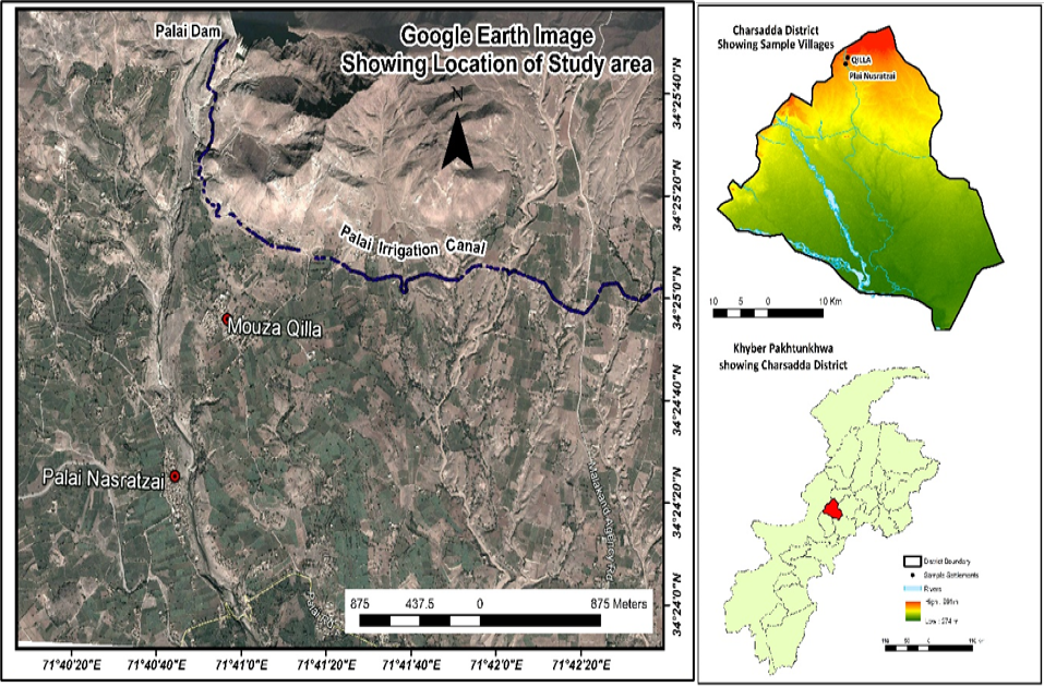
Google Earth image showing the aerial view of Palai Nasratzai and Qilla. The right part of the figure is depicting the map of Charsadda district showing location of study area.
Rabi cropping pattern of village Palai Nasratzai before (2008-09) and after dam construction (2016-17), respectively.
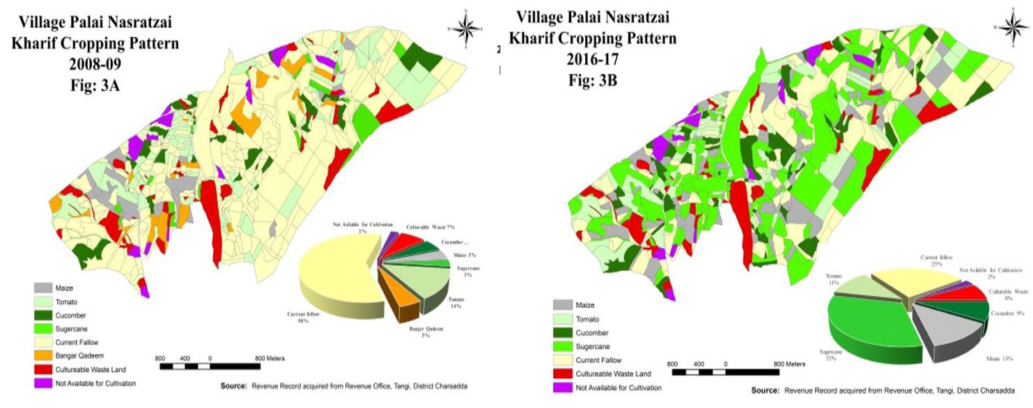
The Kharif cropping pattern of village Palai Nasratzai before (2008-09) and after dam (2016-17) construction, respectively.
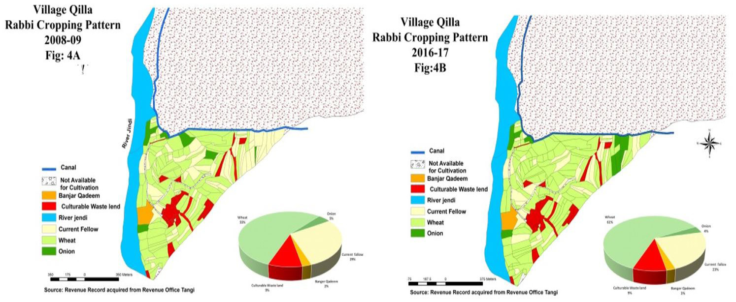
The Rabi cropping pattern of village Qilla before (2008-09) and after Dam construction (2016-17), respectively.
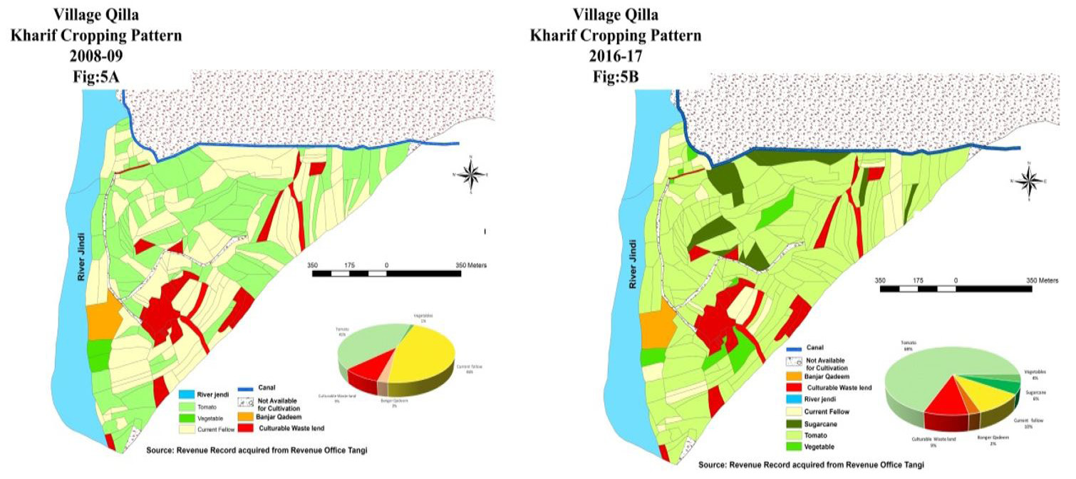
The Kharif cropping pattern of village Qilla before (2008-09) and after dam construction (2016-17), respectively.


